About PixelMonitor
PixelMonitor is a multi-user mapping application for managing and monitoring PixelCore entities using geolocation. PixelMonitor makes it possible not only to monitor the measurement results coming from devices and configure the conditions for the appearance of event notifications, but also to track the movement of certain objects.
Key features
PixelMonitor provides the ability to work with PixelCore entities in cartographic mode, tracking not only their state, but also their movement on the map, as well as presenting the most significant part of the information in a visual form. Thus, the application is designed not only to monitor the status of devices, but also to simplify the work of service personnel, since it allows not only to receive, but also to interpret the measurement results.
The main feature of PixelMonitor is that the application allows you to abstract from the technical implementation and present information in a form that is understandable to ordinary service personnel who are not directly involved in the operation of devices.
Thanks to the access sharing and filtering mechanisms implemented both in PixelCore and directly in PixelMonitor, the application allows you to display to each specific user only the information that he really needs.
PixelMonitor supports several map options, as well as the ability to place plans of premises and territories on top of maps. The application also implements a system of customizable warnings (alarms) and notifications (notifications) that can be issued when certain conditions are met.
Main elements
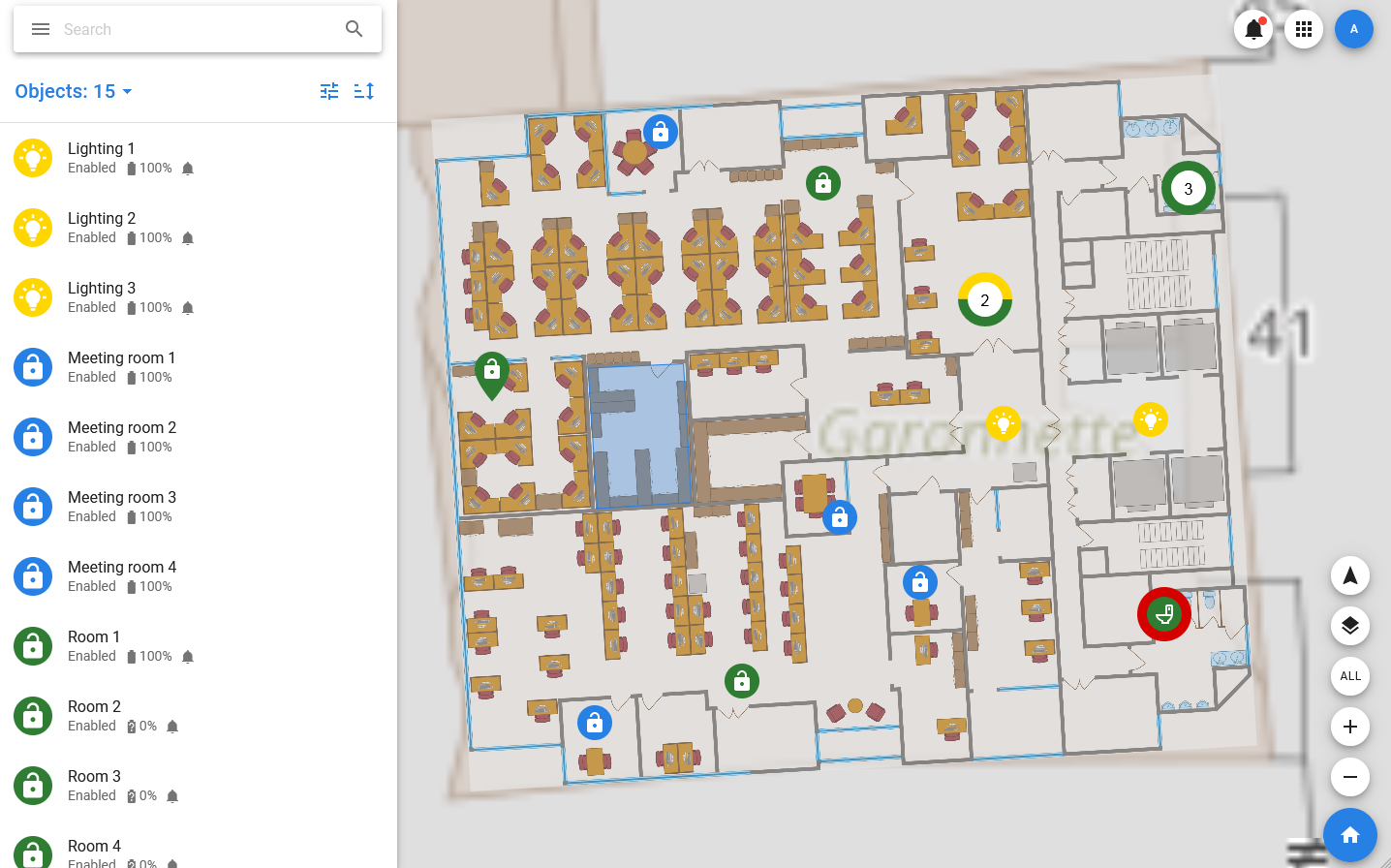
- Objects — PixelMonitor offers to consider not individual devices, but objects that can include several real or virtual devices, measurement processing results, photos, and various reference information. Thus, the user gets the opportunity to monitor not devices, but entities that are understandable to him, such as parking spaces, refrigerators, cargo carts or toilet stalls. All of them are displayed on the map and can change their appearance when the state changes.
- Plans — the application allows you to work not only with maps, but also with plans of territories and premises that can be uploaded to the system and placed on top of the map. Plans are linked to floors, which allows you to represent multi-storey buildings in the system as well.
- Groups — objects in PixelMonitor can be combined into groups, which allows you to simplify the process of organizing work with them.
- Geozones and landmarks — PixelMonitor also supports two types of «smart » groups that have a territorial reference, and allow you to generate notifications if the object is too close or too far from a given point or crosses the border of the site.
- Geotags — the application allows you to specify addresses on the map and track the movement of objects between them. The address space is three-dimensional and is set in three-dimensional space, which allows you to allocate separate floors and rooms.
- Types — the application allows you to create objects using pre-formed types, immediately setting the necessary parameters for these objects and simplifying the process of configuring and preparing them for use.
- User accounts and profiles — working with PixelMonitor is only possible for authorized users. At the same time, each user has the opportunity to customize the application interface according to their personal preferences.